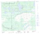
Maps showing Hansen Bay, 63-18-W3, Saskatchewan
Hansen Bay is a Bay located in 63-18-W3, Saskatchewan and has an elevation of 480 meters.
- Latitude: 54° 28' North (decimal: 54.4667616)
- Longitude: 108° 44' West (decimal: -108.7340804)
- Topography Feature Category: Bay
- Geographical Feature: Bay
- Canadian Province/Territory: Saskatchewan
- Elevation: 480 meters
- Location: 63-18-W3
- Atlas of Canada Locator Map: Hansen Bay
- GPS Coordinate Locator Map: Hansen Bay Lat/Long
Hansen Bay NTS Map Sheets