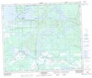
Maps showing Island Hill, 61-15-W3, Saskatchewan
Island Hill is a Mountain located in 61-15-W3, Saskatchewan and has an elevation of 459 meters.
- Latitude: 54° 18' North (decimal: 54.3000864)
- Longitude: 108° 10' West (decimal: -108.1673578)
- Topography Feature Category: Mountain
- Geographical Feature: Hill
- Canadian Province/Territory: Saskatchewan
- Elevation: 459 meters
- Location: 61-15-W3
- Atlas of Canada Locator Map: Island Hill
- GPS Coordinate Locator Map: Island Hill Lat/Long
Island Hill NTS Map Sheets