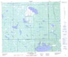
Maps showing Stump Lake, 2-59-25-W3, Saskatchewan
Stump Lake is a Lake located in 2-59-25-W3, Saskatchewan and has an elevation of 594 meters.
- Latitude: 54° 4' North (decimal: 54.0667648)
- Longitude: 109° 39' West (decimal: -109.6507732)
- Topography Feature Category: Lake
- Geographical Feature: Lake
- Canadian Province/Territory: Saskatchewan
- Elevation: 594 meters
- Location: 2-59-25-W3
- Atlas of Canada Locator Map: Stump Lake
- GPS Coordinate Locator Map: Stump Lake Lat/Long
Stump Lake NTS Map Sheets