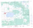
Maps showing St. Cyr Lake, 60-14-W3, Saskatchewan
St. Cyr Lake is a Unincorporated area located in 60-14-W3, Saskatchewan and has an elevation of 485 meters.
- Latitude: 54° 13' North (decimal: 54.2167520)
- Longitude: 108° 4' West (decimal: -108.0673542)
- Topography Feature Category: Unincorporated area
- Geographical Feature: Locality
- Canadian Province/Territory: Saskatchewan
- Elevation: 485 meters
- Location: 60-14-W3
- Atlas of Canada Locator Map: St. Cyr Lake
- GPS Coordinate Locator Map: St. Cyr Lake Lat/Long
St. Cyr Lake NTS Map Sheets