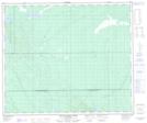
Maps showing Jacobson Lake, 28-55-16-W2, Saskatchewan
Jacobson Lake is a Lake located in 28-55-16-W2, Saskatchewan and has an elevation of 428 meters.
- Latitude: 53° 47' North (decimal: 53.7833890)
- Longitude: 104° 19' West (decimal: -104.3171047)
- Topography Feature Category: Lake
- Geographical Feature: Lake
- Canadian Province/Territory: Saskatchewan
- Elevation: 428 meters
- Location: 28-55-16-W2
- Atlas of Canada Locator Map: Jacobson Lake
- GPS Coordinate Locator Map: Jacobson Lake Lat/Long
Jacobson Lake NTS Map Sheets