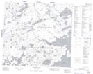
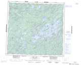
Maps showing Gaucher Lake, Saskatchewan
Gaucher Lake is a Lake located in Saskatchewan and has an elevation of 510 meters.
- Latitude: 57° 19' North (decimal: 57.3167697)
- Longitude: 107° 11' West (decimal: -107.1839807)
- Topography Feature Category: Lake
- Geographical Feature: Lake
- Canadian Province/Territory: Saskatchewan
- Elevation: 510 meters
- Atlas of Canada Locator Map: Gaucher Lake
- GPS Coordinate Locator Map: Gaucher Lake Lat/Long
Gaucher Lake NTS Map Sheets