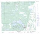
Maps showing Upper Makwa Lake, 58-22-W3, Saskatchewan
Upper Makwa Lake is a Lake located in 58-22-W3, Saskatchewan and has an elevation of 543 meters.
- Latitude: 54° 3' North (decimal: 54.0500990)
- Longitude: 109° 16' West (decimal: -109.2674203)
- Topography Feature Category: Lake
- Geographical Feature: Lake
- Canadian Province/Territory: Saskatchewan
- Elevation: 543 meters
- Location: 58-22-W3
- Atlas of Canada Locator Map: Upper Makwa Lake
- GPS Coordinate Locator Map: Upper Makwa Lake Lat/Long
Upper Makwa Lake NTS Map Sheets