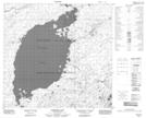
Maps showing Smith Island, Saskatchewan
Smith Island is a Island located in Saskatchewan and has an elevation of 417 meters.
- Latitude: 58° 27' North (decimal: 58.4501388)
- Longitude: 105° 16' West (decimal: -105.2672506)
- Topography Feature Category: Island
- Geographical Feature: Island
- Canadian Province/Territory: Saskatchewan
- Elevation: 417 meters
- Atlas of Canada Locator Map: Smith Island
- GPS Coordinate Locator Map: Smith Island Lat/Long
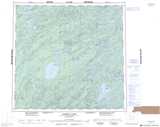
Smith Island NTS Map Sheets