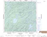
Maps showing Mitchell Bay, Saskatchewan
Mitchell Bay is a Bay located in Saskatchewan and has an elevation of 436 meters.
- Latitude: 58° 16' North (decimal: 58.2668006)
- Longitude: 104° 38' West (decimal: -104.6338503)
- Topography Feature Category: Bay
- Geographical Feature: Bay
- Canadian Province/Territory: Saskatchewan
- Elevation: 436 meters
- Atlas of Canada Locator Map: Mitchell Bay
- GPS Coordinate Locator Map: Mitchell Bay Lat/Long
Mitchell Bay NTS Map Sheets