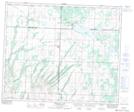
Maps showing Meeting Lake Regional Park, 49-12-W3, Saskatchewan
Meeting Lake Regional Park is a Conservation area located in 49-12-W3, Saskatchewan and has an elevation of 756 meters.
- Latitude: 53° 11' 45'' North (decimal: 53.1958995)
- Longitude: 107° 42' 32'' West (decimal: -107.7089599)
- Topography Feature Category: Conservation area
- Geographical Feature: Regional Park
- Canadian Province/Territory: Saskatchewan
- Elevation: 756 meters
- Location: 49-12-W3
- Atlas of Canada Locator Map: Meeting Lake Regional Park
- GPS Coordinate Locator Map: Meeting Lake Regional Park Lat/Long
Meeting Lake Regional Park NTS Map Sheets