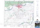
Maps showing Campbell Marsh, 24,25-47-27-W2, Saskatchewan
Campbell Marsh is a Low vegetation located in 24,25-47-27-W2, Saskatchewan and has an elevation of 453 meters.
- Latitude: 53° 8' North (decimal: 53.1333761)
- Longitude: 105° 51' West (decimal: -105.8505181)
- Topography Feature Category: Low vegetation
- Geographical Feature: Marsh
- Canadian Province/Territory: Saskatchewan
- Elevation: 453 meters
- Location: 24,25-47-27-W2
- Atlas of Canada Locator Map: Campbell Marsh
- GPS Coordinate Locator Map: Campbell Marsh Lat/Long
Campbell Marsh NTS Map Sheets