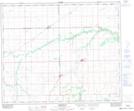
Maps showing Pasquia Regional Park, 48-11-W2, Saskatchewan
Pasquia Regional Park is a Conservation area located in 48-11-W2, Saskatchewan and has an elevation of 336 meters.
- Latitude: 53° 11' 20'' North (decimal: 53.1889190)
- Longitude: 103° 34' 47'' West (decimal: -103.5796350)
- Topography Feature Category: Conservation area
- Geographical Feature: Regional Park
- Canadian Province/Territory: Saskatchewan
- Elevation: 336 meters
- Location: 48-11-W2
- Atlas of Canada Locator Map: Pasquia Regional Park
- GPS Coordinate Locator Map: Pasquia Regional Park Lat/Long
Pasquia Regional Park NTS Map Sheets