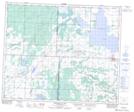
Maps showing Sylvander Lake, 51,52-12-W3, Saskatchewan
Sylvander Lake is a Lake located in 51,52-12-W3, Saskatchewan and has an elevation of 588 meters.
- Latitude: 53° 27' North (decimal: 53.4500681)
- Longitude: 107° 40' West (decimal: -107.6672929)
- Topography Feature Category: Lake
- Geographical Feature: Lake
- Canadian Province/Territory: Saskatchewan
- Elevation: 588 meters
- Location: 51,52-12-W3
- Atlas of Canada Locator Map: Sylvander Lake
- GPS Coordinate Locator Map: Sylvander Lake Lat/Long
Sylvander Lake NTS Map Sheets