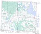
Maps showing Laventure, 2-52-11-W3, Saskatchewan
Laventure is a Unincorporated area located in 2-52-11-W3, Saskatchewan and has an elevation of 590 meters.
- Latitude: 53° 28' North (decimal: 53.4667308)
- Longitude: 107° 31' West (decimal: -107.5172818)
- Topography Feature Category: Unincorporated area
- Geographical Feature: Locality
- Canadian Province/Territory: Saskatchewan
- Elevation: 590 meters
- Location: 2-52-11-W3
- Atlas of Canada Locator Map: Laventure
- GPS Coordinate Locator Map: Laventure Lat/Long
Laventure NTS Map Sheets