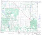
Maps showing Canwood Regional Park, 50-4-W3, Saskatchewan
Canwood Regional Park is a Conservation area located in 50-4-W3, Saskatchewan and has an elevation of 520 meters.
- Latitude: 53° 21' 40'' North (decimal: 53.3611596)
- Longitude: 106° 32' 32'' West (decimal: -106.5422167)
- Topography Feature Category: Conservation area
- Geographical Feature: Regional Park
- Canadian Province/Territory: Saskatchewan
- Elevation: 520 meters
- Location: 50-4-W3
- Atlas of Canada Locator Map: Canwood Regional Park
- GPS Coordinate Locator Map: Canwood Regional Park Lat/Long