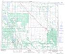
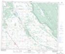
Maps showing Bérubé Lake, 52-7-W3, Saskatchewan
Bérubé Lake is a Lake located in 52-7-W3, Saskatchewan and has an elevation of 516 meters.
- Latitude: 53° 29' North (decimal: 53.4833844)
- Longitude: 106° 57' West (decimal: -106.9505729)
- Topography Feature Category: Lake
- Geographical Feature: Lake
- Canadian Province/Territory: Saskatchewan
- Elevation: 516 meters
- Location: 52-7-W3
- Atlas of Canada Locator Map: Bérubé Lake
- GPS Coordinate Locator Map: Bérubé Lake Lat/Long
Bérubé Lake NTS Map Sheets