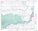
Maps showing Codette Station, 6-50-14-W2, Saskatchewan
Codette Station is a Unincorporated area located in 6-50-14-W2, Saskatchewan.
- Latitude: 53° 17' North (decimal: 53.2833676)
- Longitude: 104° 2' West (decimal: -104.0337991)
- Topography Feature Category: Unincorporated area
- Geographical Feature: Railway Point
- Canadian Province/Territory: Saskatchewan
- Location: 6-50-14-W2
- GPS Coordinate Locator Map: Codette Station Lat/Long
Codette Station NTS Map Sheets