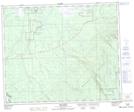
Maps showing Red Earth, Saskatchewan
Red Earth is a Unincorporated area located in Saskatchewan and has an elevation of 266 meters.
- Latitude: 53° 29' North (decimal: 53.4833752)
- Longitude: 102° 52' West (decimal: -102.8671357)
- Topography Feature Category: Unincorporated area
- Geographical Feature: Locality
- Canadian Province/Territory: Saskatchewan
- Elevation: 266 meters
- Atlas of Canada Locator Map: Red Earth
- GPS Coordinate Locator Map: Red Earth Lat/Long
Red Earth NTS Map Sheets