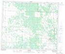
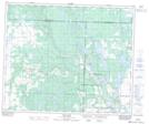
Maps showing Bland Lake, 16,21-52-9-W3, Saskatchewan
Bland Lake is a Lake located in 16,21-52-9-W3, Saskatchewan and has an elevation of 637 meters.
- Latitude: 53° 30' North (decimal: 53.5000572)
- Longitude: 107° 17' West (decimal: -107.2839302)
- Topography Feature Category: Lake
- Geographical Feature: Lake
- Canadian Province/Territory: Saskatchewan
- Elevation: 637 meters
- Location: 16,21-52-9-W3
- Atlas of Canada Locator Map: Bland Lake
- GPS Coordinate Locator Map: Bland Lake Lat/Long
Bland Lake NTS Map Sheets