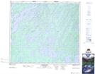
Maps showing Rogers Bay, Saskatchewan
Rogers Bay is a Bay located in Saskatchewan and has an elevation of 393 meters.
- Latitude: 55° 30' North (decimal: 55.5000683)
- Longitude: 105° 50' West (decimal: -105.8338232)
- Topography Feature Category: Bay
- Geographical Feature: Bay
- Canadian Province/Territory: Saskatchewan
- Elevation: 393 meters
- Atlas of Canada Locator Map: Rogers Bay
- GPS Coordinate Locator Map: Rogers Bay Lat/Long
Rogers Bay NTS Map Sheets