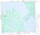
Maps showing St. George's Hill, 79-19-W3, Saskatchewan
St. George's Hill is a Hamlet located in 79-19-W3, Saskatchewan and has an elevation of 427 meters.
- Latitude: 55° 52' 48'' North (decimal: 55.8800028)
- Longitude: 108° 57' 45'' West (decimal: -108.9625916)
- Topography Feature Category: Hamlet
- Geographical Feature: Northern Hamlet
- Canadian Province/Territory: Saskatchewan
- Elevation: 427 meters
- Location: 79-19-W3
- Atlas of Canada Locator Map: St. George's Hill
- GPS Coordinate Locator Map: St. George's Hill Lat/Long
St. George's Hill NTS Map Sheets