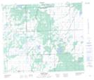
Maps showing Four Corners, 60-18-W3, Saskatchewan
Four Corners is a Unincorporated area located in 60-18-W3, Saskatchewan and has an elevation of 492 meters.
- Latitude: 54° 11' North (decimal: 54.1834261)
- Longitude: 108° 38' West (decimal: -108.6340499)
- Topography Feature Category: Unincorporated area
- Geographical Feature: Locality
- Canadian Province/Territory: Saskatchewan
- Elevation: 492 meters
- Location: 60-18-W3
- Atlas of Canada Locator Map: Four Corners
- GPS Coordinate Locator Map: Four Corners Lat/Long
Four Corners NTS Map Sheets