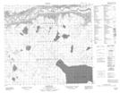
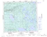
Maps showing Portage La Loche, Saskatchewan
Portage La Loche is a Road feature located in Saskatchewan and has an elevation of 470 meters.
- Latitude: 56° 38' North (decimal: 56.6334489)
- Longitude: 109° 45' West (decimal: -109.7508114)
- Topography Feature Category: Road feature
- Geographical Feature: Portage
- Canadian Province/Territory: Saskatchewan
- Elevation: 470 meters
- Atlas of Canada Locator Map: Portage La Loche
- GPS Coordinate Locator Map: Portage La Loche Lat/Long
Portage La Loche NTS Map Sheets