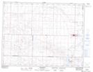
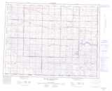
Maps showing Thomson Lake Regional Park, 9-5-W3, Saskatchewan
Thomson Lake Regional Park is a Conservation area located in 9-5-W3, Saskatchewan and has an elevation of 702 meters.
- Latitude: 49° 46' 30'' North (decimal: 49.7750288)
- Longitude: 106° 34' 32'' West (decimal: -106.5756097)
- Topography Feature Category: Conservation area
- Geographical Feature: Regional Park
- Canadian Province/Territory: Saskatchewan
- Elevation: 702 meters
- Location: 9-5-W3
- Atlas of Canada Locator Map: Thomson Lake Regional Park
- GPS Coordinate Locator Map: Thomson Lake Regional Park Lat/Long
Thomson Lake Regional Park NTS Map Sheets