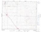
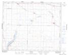
Maps showing Lost River No. 313, Saskatchewan
Lost River No. 313 is a Other municipal/district area - miscellaneous located in Saskatchewan.
- Latitude: 51° 45' 3'' North (decimal: 51.7507489)
- Longitude: 106° 8' 46'' West (decimal: -106.1460722)
- Topography Feature Category: Other municipal/district area - miscellaneous
- Geographical Feature: Rural Municipality
- Canadian Province/Territory: Saskatchewan
- Atlas of Canada Locator Map: Lost River No. 313
- GPS Coordinate Locator Map: Lost River No. 313 Lat/Long
Lost River No. 313 NTS Map Sheets