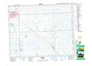
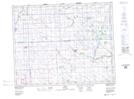
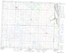
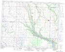
Maps showing Calder No. 241, Saskatchewan
Calder No. 241 is a Other municipal/district area - miscellaneous located in Saskatchewan.
- Latitude: 51° 15' 26'' North (decimal: 51.2573514)
- Longitude: 101° 43' 42'' West (decimal: -101.7282744)
- Topography Feature Category: Other municipal/district area - miscellaneous
- Geographical Feature: Rural Municipality
- Canadian Province/Territory: Saskatchewan
- Atlas of Canada Locator Map: Calder No. 241
- GPS Coordinate Locator Map: Calder No. 241 Lat/Long
Calder No. 241 NTS Map Sheets