Maps showing Lacadena No. 228, Saskatchewan
Lacadena No. 228 is a Other municipal/district area - miscellaneous located in Saskatchewan.
- Latitude: 50° 45' 31'' North (decimal: 50.7585507)
- Longitude: 108° 12' 42'' West (decimal: -108.2117008)
- Topography Feature Category: Other municipal/district area - miscellaneous
- Geographical Feature: Rural Municipality
- Canadian Province/Territory: Saskatchewan
- Atlas of Canada Locator Map: Lacadena No. 228
- GPS Coordinate Locator Map: Lacadena No. 228 Lat/Long
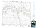
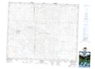
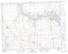
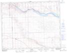
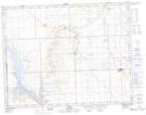
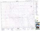
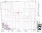
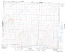
Lacadena No. 228 NTS Map Sheets
072J12 Stewart Valley Topographic Map at 1:50,000 scale
072J13 Matador Topographic Map at 1:50,000 scale
072K09 Cabri Topographic Map at 1:50,000 scale
072K15 Lancer Topographic Map at 1:50,000 scale
072K16 Kyle Topographic Map at 1:50,000 scale
072N01 Wartime Topographic Map at 1:50,000 scale
072N02 Eston Topographic Map at 1:50,000 scale
072O04 Hughton Topographic Map at 1:50,000 scale
072J Swift Current Topographic Map at 1:250,000 scale
072K Prelate Topographic Map at 1:250,000 scale
072N Kindersley Topographic Map at 1:250,000 scale
072O Rosetown Topographic Map at 1:250,000 scale