Canada Topographic Maps

Maple Bush No. 224 Topo Maps

Topography maps and Latitude/Longitude Location

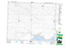
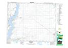
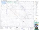
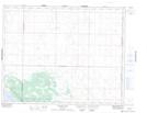
Maps showing Maple Bush No. 224, Saskatchewan

Maple Bush No. 224 is a Other municipal/district area - miscellaneous located in Saskatchewan.

  • Latitude: 50° 58' 52'' North   (decimal: 50.9811198)
  • Longitude: 106° 46' 20'' West   (decimal: -106.7723582)
  • Topography Feature Category: Other municipal/district area - miscellaneous
  • Geographical Feature: Rural Municipality
  • Canadian Province/Territory: Saskatchewan
  • Atlas of Canada Locator Map: Maple Bush No. 224
  • GPS Coordinate Locator Map: Maple Bush No. 224 Lat/Long

Maple Bush No. 224 NTS Map Sheets

072J14 Beechy Topographic Map at 1:50,000 scale

072J15 Riverhurst Topographic Map at 1:50,000 scale

072J16 Eyebrow Topographic Map at 1:50,000 scale

072O01 Kramer Lake Topographic Map at 1:50,000 scale

072O02 Elbow Topographic Map at 1:50,000 scale

072J Swift Current Topographic Map at 1:250,000 scale

072O Rosetown Topographic Map at 1:250,000 scale

 
Buy Topographic Maps DVD
Newsletter Sign-up

Yes, I want to receive map store discounts.


Bookmark and Share