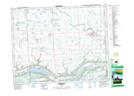
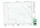
Maps showing Fertile Belt No. 183, Saskatchewan
Fertile Belt No. 183 is a Other municipal/district area - miscellaneous located in Saskatchewan.
- Latitude: 50° 37' 3'' North (decimal: 50.6175708)
- Longitude: 102° 13' 54'' West (decimal: -102.2317050)
- Topography Feature Category: Other municipal/district area - miscellaneous
- Geographical Feature: Rural Municipality
- Canadian Province/Territory: Saskatchewan
- Atlas of Canada Locator Map: Fertile Belt No. 183
- GPS Coordinate Locator Map: Fertile Belt No. 183 Lat/Long
Fertile Belt No. 183 NTS Map Sheets