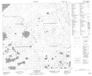
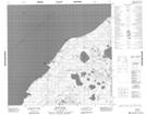
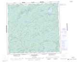
Maps showing Lillabo Lake, Saskatchewan
Lillabo Lake is a Lake located in Saskatchewan and has an elevation of 253 meters.
- Latitude: 58° 52' North (decimal: 58.8668189)
- Longitude: 110° 0' West (decimal: -110.0009237)
- Topography Feature Category: Lake
- Geographical Feature: Lake
- Canadian Province/Territory: Saskatchewan
- Elevation: 253 meters
- Atlas of Canada Locator Map: Lillabo Lake
- GPS Coordinate Locator Map: Lillabo Lake Lat/Long
Lillabo Lake NTS Map Sheets