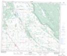
Maps showing Lake Four, 27-54-6-W3, Saskatchewan
Lake Four is a Unincorporated area located in 27-54-6-W3, Saskatchewan and has an elevation of 503 meters.
- Latitude: 53° 42' North (decimal: 53.7000529)
- Longitude: 106° 47' West (decimal: -106.7838867)
- Topography Feature Category: Unincorporated area
- Geographical Feature: Locality
- Canadian Province/Territory: Saskatchewan
- Elevation: 503 meters
- Location: 27-54-6-W3
- Atlas of Canada Locator Map: Lake Four
- GPS Coordinate Locator Map: Lake Four Lat/Long