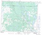
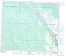
Maps showing Leoville Hills, 54-10-W3, Saskatchewan
Leoville Hills is a Mountain located in 54-10-W3, Saskatchewan and has an elevation of 610 meters.
- Latitude: 53° 40' North (decimal: 53.6667297)
- Longitude: 107° 26' West (decimal: -107.4339367)
- Topography Feature Category: Mountain
- Geographical Feature: Hills
- Canadian Province/Territory: Saskatchewan
- Elevation: 610 meters
- Location: 54-10-W3
- Atlas of Canada Locator Map: Leoville Hills
- GPS Coordinate Locator Map: Leoville Hills Lat/Long
Leoville Hills NTS Map Sheets