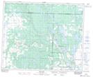
Maps showing Capasin, 53-10-W3, Saskatchewan
Capasin is a Unincorporated area located in 53-10-W3, Saskatchewan and has an elevation of 597 meters.
- Latitude: 53° 36' North (decimal: 53.6000603)
- Longitude: 107° 23' West (decimal: -107.3839335)
- Topography Feature Category: Unincorporated area
- Geographical Feature: Locality
- Canadian Province/Territory: Saskatchewan
- Elevation: 597 meters
- Location: 53-10-W3
- Atlas of Canada Locator Map: Capasin
- GPS Coordinate Locator Map: Capasin Lat/Long
Capasin NTS Map Sheets