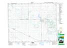
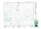
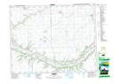
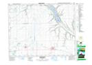
Maps showing Indian Head No. 156, Saskatchewan
Indian Head No. 156 is a Other municipal/district area - miscellaneous located in Saskatchewan.
- Latitude: 50° 35' 45'' North (decimal: 50.5958056)
- Longitude: 103° 33' 39'' West (decimal: -103.5609111)
- Topography Feature Category: Other municipal/district area - miscellaneous
- Geographical Feature: Rural Municipality
- Canadian Province/Territory: Saskatchewan
- Atlas of Canada Locator Map: Indian Head No. 156
- GPS Coordinate Locator Map: Indian Head No. 156 Lat/Long
Indian Head No. 156 NTS Map Sheets