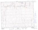
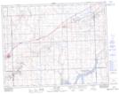
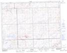
Maps showing Carmichael No. 109, Saskatchewan
Carmichael No. 109 is a Other municipal/district area - miscellaneous located in Saskatchewan.
- Latitude: 49° 56' 15'' North (decimal: 49.9373921)
- Longitude: 108° 39' 13'' West (decimal: -108.6535833)
- Topography Feature Category: Other municipal/district area - miscellaneous
- Geographical Feature: Rural Municipality
- Canadian Province/Territory: Saskatchewan
- Atlas of Canada Locator Map: Carmichael No. 109
- GPS Coordinate Locator Map: Carmichael No. 109 Lat/Long
Carmichael No. 109 NTS Map Sheets