Canada Topographic Maps

Val Marie No. 17 Topo Maps

Topography maps and Latitude/Longitude Location

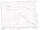
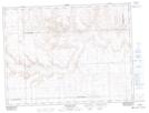
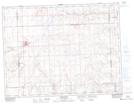
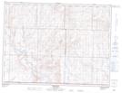
Maps showing Val Marie No. 17, Saskatchewan

Val Marie No. 17 is a Other municipal/district area - miscellaneous located in Saskatchewan.

  • Latitude: 49° 13' 33'' North   (decimal: 49.2257759)
  • Longitude: 107° 43' 0'' West   (decimal: -107.7166738)
  • Topography Feature Category: Other municipal/district area - miscellaneous
  • Geographical Feature: Rural Municipality
  • Canadian Province/Territory: Saskatchewan
  • Atlas of Canada Locator Map: Val Marie No. 17
  • GPS Coordinate Locator Map: Val Marie No. 17 Lat/Long

Val Marie No. 17 NTS Map Sheets

072F01 Climax Topographic Map at 1:50,000 scale

072F08 Badland Lake Topographic Map at 1:50,000 scale

072F09 Shaunavon Topographic Map at 1:50,000 scale

072G03 Wideview Topographic Map at 1:50,000 scale

072G04 Orkney Topographic Map at 1:50,000 scale

072G05 Hillandale Topographic Map at 1:50,000 scale

072G06 Mankota Topographic Map at 1:50,000 scale

072G12 Cadillac Topographic Map at 1:50,000 scale

072F Cypress Lake Topographic Map at 1:250,000 scale

072G Wood Mountain Topographic Map at 1:250,000 scale

 
Buy Topographic Maps DVD
Newsletter Sign-up

Yes, I want to receive map store discounts.


Bookmark and Share