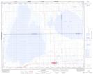
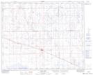
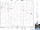
Maps showing Ironspring Creek, 35-18-W2, Saskatchewan
Ironspring Creek is a River located in 35-18-W2, Saskatchewan and has an elevation of 532 meters.
- Latitude: 52° 0' North (decimal: 52.0000188)
- Longitude: 104° 28' West (decimal: -104.4672016)
- Topography Feature Category: River
- Geographical Feature: Creek
- Canadian Province/Territory: Saskatchewan
- Elevation: 532 meters
- Location: 35-18-W2
- Atlas of Canada Locator Map: Ironspring Creek
- GPS Coordinate Locator Map: Ironspring Creek Lat/Long
Ironspring Creek NTS Map Sheets