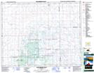
Maps showing Dafoe Brook, 20-32-18-W2, Saskatchewan
Dafoe Brook is a River located in 20-32-18-W2, Saskatchewan and has an elevation of 530 meters.
- Latitude: 51° 46' North (decimal: 51.7666915)
- Longitude: 104° 31' West (decimal: -104.5172108)
- Topography Feature Category: River
- Geographical Feature: Brook
- Canadian Province/Territory: Saskatchewan
- Elevation: 530 meters
- Location: 20-32-18-W2
- Atlas of Canada Locator Map: Dafoe Brook
- GPS Coordinate Locator Map: Dafoe Brook Lat/Long
Dafoe Brook NTS Map Sheets