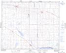
Maps showing Sclanders, 34-26-W2, Saskatchewan
Sclanders is a Unincorporated area located in 34-26-W2, Saskatchewan and has an elevation of 561 meters.
- Latitude: 51° 57' North (decimal: 51.9500334)
- Longitude: 105° 34' West (decimal: -105.5672491)
- Topography Feature Category: Unincorporated area
- Geographical Feature: Locality
- Canadian Province/Territory: Saskatchewan
- Elevation: 561 meters
- Location: 34-26-W2
- Atlas of Canada Locator Map: Sclanders
- GPS Coordinate Locator Map: Sclanders Lat/Long