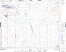
Maps showing Lockwood, 11-31-22-W2, Saskatchewan
Lockwood is a Hamlet located in 11-31-22-W2, Saskatchewan and has an elevation of 522 meters.
- Latitude: 51° 39' North (decimal: 51.6500319)
- Longitude: 105° 1' West (decimal: -105.0172325)
- Topography Feature Category: Hamlet
- Geographical Feature: Hamlet
- Canadian Province/Territory: Saskatchewan
- Elevation: 522 meters
- Location: 11-31-22-W2
- Atlas of Canada Locator Map: Lockwood
- GPS Coordinate Locator Map: Lockwood Lat/Long