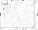
Maps showing Watrous, 22-31-25-W2, Saskatchewan
Watrous is a Town located in 22-31-25-W2, Saskatchewan and has an elevation of 540 meters.
- Latitude: 51° 41' 7'' North (decimal: 51.6851613)
- Longitude: 105° 27' 48'' West (decimal: -105.4634693)
- Topography Feature Category: Town
- Geographical Feature: Town
- Canadian Province/Territory: Saskatchewan
- Elevation: 540 meters
- Location: 22-31-25-W2
- Atlas of Canada Locator Map: Watrous
- GPS Coordinate Locator Map: Watrous Lat/Long