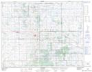
Maps showing Punnichy, 2-28-17-W2, Saskatchewan
Punnichy is a Village located in 2-28-17-W2, Saskatchewan and has an elevation of 646 meters.
- Latitude: 51° 22' 17'' North (decimal: 51.3715167)
- Longitude: 104° 17' 51'' West (decimal: -104.2976027)
- Topography Feature Category: Village
- Geographical Feature: Village
- Canadian Province/Territory: Saskatchewan
- Elevation: 646 meters
- Location: 2-28-17-W2
- Atlas of Canada Locator Map: Punnichy
- GPS Coordinate Locator Map: Punnichy Lat/Long