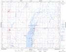
Maps showing Simpson, 3-29-25-W2, Saskatchewan
Simpson is a Village located in 3-29-25-W2, Saskatchewan and has an elevation of 519 meters.
- Latitude: 51° 27' 9'' North (decimal: 51.4525983)
- Longitude: 105° 26' 42'' West (decimal: -105.4450278)
- Topography Feature Category: Village
- Geographical Feature: Village
- Canadian Province/Territory: Saskatchewan
- Elevation: 519 meters
- Location: 3-29-25-W2
- Atlas of Canada Locator Map: Simpson
- GPS Coordinate Locator Map: Simpson Lat/Long