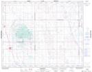
Maps showing Cymric, 27-26-22-W2, Saskatchewan
Cymric is a Unincorporated area located in 27-26-22-W2, Saskatchewan and has an elevation of 530 meters.
- Latitude: 51° 14' North (decimal: 51.2333713)
- Longitude: 104° 59' West (decimal: -104.9839073)
- Topography Feature Category: Unincorporated area
- Geographical Feature: Locality
- Canadian Province/Territory: Saskatchewan
- Elevation: 530 meters
- Location: 27-26-22-W2
- Atlas of Canada Locator Map: Cymric
- GPS Coordinate Locator Map: Cymric Lat/Long