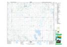
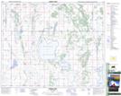
Maps showing Siba Lake, 40,41-23-W2, Saskatchewan
Siba Lake is a Lake located in 40,41-23-W2, Saskatchewan and has an elevation of 589 meters.
- Latitude: 52° 30' North (decimal: 52.5000243)
- Longitude: 105° 17' West (decimal: -105.2838729)
- Topography Feature Category: Lake
- Geographical Feature: Lake
- Canadian Province/Territory: Saskatchewan
- Elevation: 589 meters
- Location: 40,41-23-W2
- Atlas of Canada Locator Map: Siba Lake
- GPS Coordinate Locator Map: Siba Lake Lat/Long
Siba Lake NTS Map Sheets