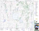
Maps showing Pelican Island, 24-41-23-W2, Saskatchewan
Pelican Island is a Island located in 24-41-23-W2, Saskatchewan.
- Latitude: 52° 33' North (decimal: 52.5500220)
- Longitude: 105° 11' West (decimal: -105.1838660)
- Topography Feature Category: Island
- Geographical Feature: Island
- Canadian Province/Territory: Saskatchewan
- Location: 24-41-23-W2
- GPS Coordinate Locator Map: Pelican Island Lat/Long