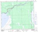
Maps showing Ravendale, 3-53-10-W2, Saskatchewan
Ravendale is a Unincorporated area located in 3-53-10-W2, Saskatchewan and has an elevation of 323 meters.
- Latitude: 53° 33' North (decimal: 53.5500443)
- Longitude: 103° 24' West (decimal: -103.4004537)
- Topography Feature Category: Unincorporated area
- Geographical Feature: Locality
- Canadian Province/Territory: Saskatchewan
- Elevation: 323 meters
- Location: 3-53-10-W2
- Atlas of Canada Locator Map: Ravendale
- GPS Coordinate Locator Map: Ravendale Lat/Long
Ravendale NTS Map Sheets