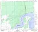
Maps showing Goose Island, 52,53-12,13-W2, Saskatchewan
Goose Island is a Island located in 52,53-12,13-W2, Saskatchewan.
- Latitude: 53° 33' North (decimal: 53.5500480)
- Longitude: 103° 46' West (decimal: -103.7671156)
- Topography Feature Category: Island
- Geographical Feature: Island
- Canadian Province/Territory: Saskatchewan
- Location: 52,53-12,13-W2
- GPS Coordinate Locator Map: Goose Island Lat/Long
Goose Island NTS Map Sheets