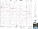
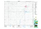
Maps showing Muenster, 19-37-21-W2, Saskatchewan
Muenster is a Village located in 19-37-21-W2, Saskatchewan and has an elevation of 569 meters.
- Latitude: 52° 11' 28'' North (decimal: 52.1911833)
- Longitude: 104° 59' 38'' West (decimal: -104.9937999)
- Topography Feature Category: Village
- Geographical Feature: Village
- Canadian Province/Territory: Saskatchewan
- Elevation: 569 meters
- Location: 19-37-21-W2
- Atlas of Canada Locator Map: Muenster
- GPS Coordinate Locator Map: Muenster Lat/Long
Muenster NTS Map Sheets