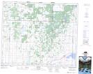
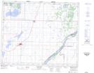
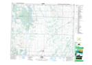
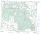
Maps showing Martins Lake Regional Park, 46-7-W3, Saskatchewan
Martins Lake Regional Park is a Conservation area located in 46-7-W3, Saskatchewan and has an elevation of 541 meters.
- Latitude: 53° 0' North (decimal: 53.0000489)
- Longitude: 107° 0' West (decimal: -107.0005812)
- Topography Feature Category: Conservation area
- Geographical Feature: Regional Park
- Canadian Province/Territory: Saskatchewan
- Elevation: 541 meters
- Location: 46-7-W3
- Atlas of Canada Locator Map: Martins Lake Regional Park
- GPS Coordinate Locator Map: Martins Lake Regional Park Lat/Long
Martins Lake Regional Park NTS Map Sheets